
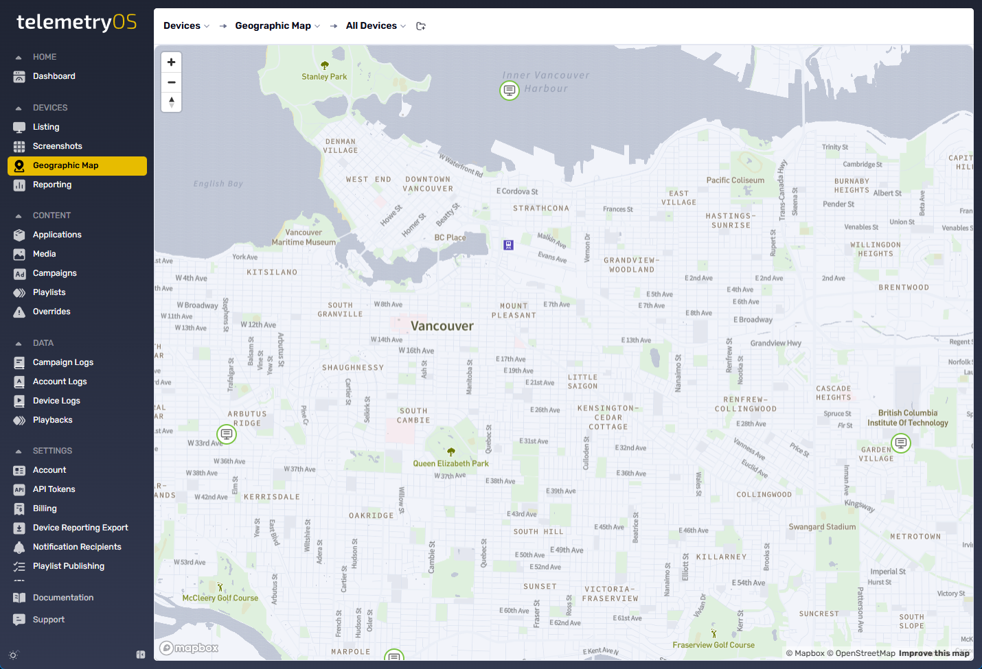
Geographic Map
Device location visualization
Geographic Map
The Geographic Map feature visualizes deployed device networks on interactive maps, showing physical device locations in real-time. This visualization supports IT administrators and operations teams in monitoring device health, troubleshooting issues, and managing distributed signage networks across geographic regions.
Map Visualization
Each device appears as a pin on the map, positioned according to its configured location:
| Location Source | Accuracy | Configuration |
|---|---|---|
| Manual location entry | Exact (user-defined coordinates) | Dashboard configuration (Devices > [Device] > Location) |
| IP-based geolocation | City-level (approximate) | Automatic derivation from device IP address |
Device pin interaction reveals detailed panels containing:
Device identification:
- Device name
- Status (online/offline)
- Last check-in time
Configuration details:
- Firmware version
- Assigned content playlist
- Active alerts
This visualization enables immediate health and status assessment of signage endpoints, particularly valuable for large-scale or multi-region deployments.
Filtering and Grouping
Map filtering and grouping options support focused device views:
Geographic filtering:
- Zoom into specific areas
- Drill into cities or regions
- Geographic region selection
Status filtering:
- Offline-only devices
- Online-only devices
- Devices with active alerts
Content filtering:
- Filter by playlist assignment
- Filter by content type
Tag-based filtering:
- Search by device tags
- Group by tag categories
- Multi-tag filtering
For organizations managing thousands of devices globally, the map functions as a mission control-style tool for high-level monitoring and geographic triage.
Implementation
The Map feature integrates directly into the Devices tab of the TelemetryOS dashboard:
Access: Devices > Map view (toggle in upper right)
Setup requirements: Each device requires accurate location metadata (manual entry or automatic IP-based geolocation)
No additional configuration: Map functionality activates automatically with location data present
The feature supports enterprise IT teams coordinating with field teams, regional managers, or facility staff, delivering real-world visualization of signage infrastructure.
Common Use Cases
Multi-location retail: Visualize store-by-store device health across geographic regions
Corporate campuses: Monitor distributed devices across multiple buildings and locations
Transportation hubs: Track device status across airports, train stations, or transit systems
Healthcare networks: Manage devices across multiple facilities and departments
Education campuses: Monitor signage across distributed campus buildings
Field service coordination: Identify offline devices for field team dispatch
Incident response: Geographic triage for widespread outages or issues
Deployment planning: Visualize coverage density and identify gaps
Map Interaction
Pan and zoom: Standard map controls for geographic navigation
Pin clustering: Multiple nearby devices cluster at higher zoom levels
Pin selection: Click pins to reveal device detail panels
Status indicators: Color-coded pins by device status (green=online, red=offline, yellow=alerts)
Location Data Management
Manual Location Entry
Manual location configuration occurs at device level:
Configuration location: Devices > [Device] > Details > Location
Input format: Address string, coordinates, or place name
Geocoding: Address text converts to map coordinates automatically
IP-Based Geolocation
Automatic location derivation from device IP addresses:
Accuracy: City-level (approximate, not building-specific)
Update frequency: Each device check-in
Override: Manual location entry overrides IP-based location
Location Data Quality
| Location Method | Precision | Use Case |
|---|---|---|
| Manual coordinates | Exact (building/floor) | Known device deployments, permanent installations |
| Manual address | Building-level | Known addresses, permanent locations |
| IP-based geolocation | City-level | Dynamic deployments, testing, approximate tracking |
Configuration Specifications
Geographic Map accesses through Devices interface (Devices > Map view toggle).
Required Data
- Device location (manual entry or IP-based geolocation)
Optional Data
- Device tags for filtering
- Device status (online/offline automatically tracked)
- Playlist assignments
Limitations
- IP-based geolocation city-level accuracy only (not building-specific)
- Map requires browser with JavaScript enabled
- Very large fleets (10,000+ devices) may experience slower map rendering
- Pin clustering reduces detail at higher zoom levels
- Location updates sync within 30-60 seconds (not real-time)
- Manual location changes require device page access (no bulk location updates)
- No custom map layers or overlays
- No distance measurement or geographic search radius
- Export map visualization as image not supported (screenshot required)
- Historical location tracking not supported (current location only)